All posts by teamcomm

Ecosystem Based Management Tools Training

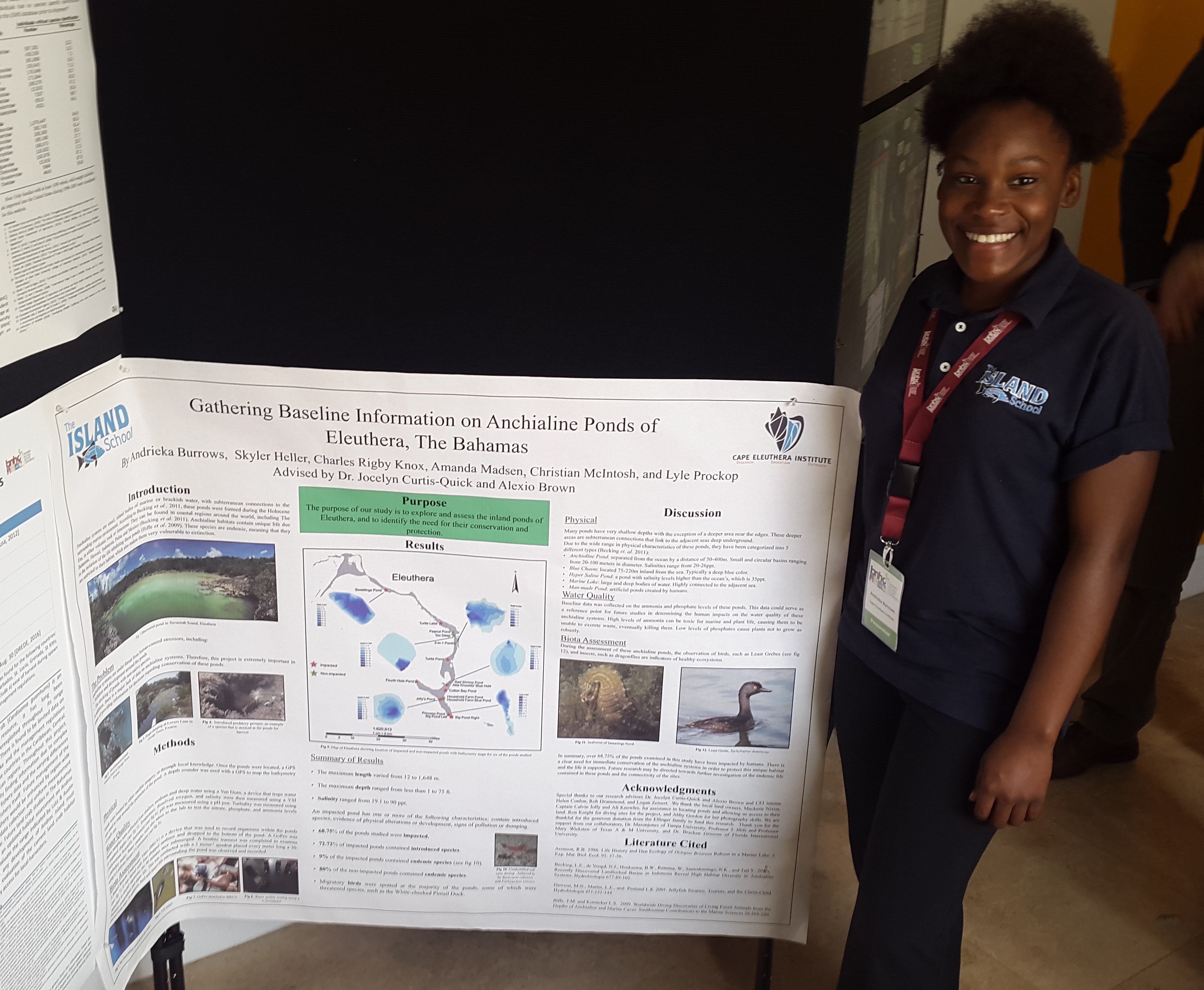
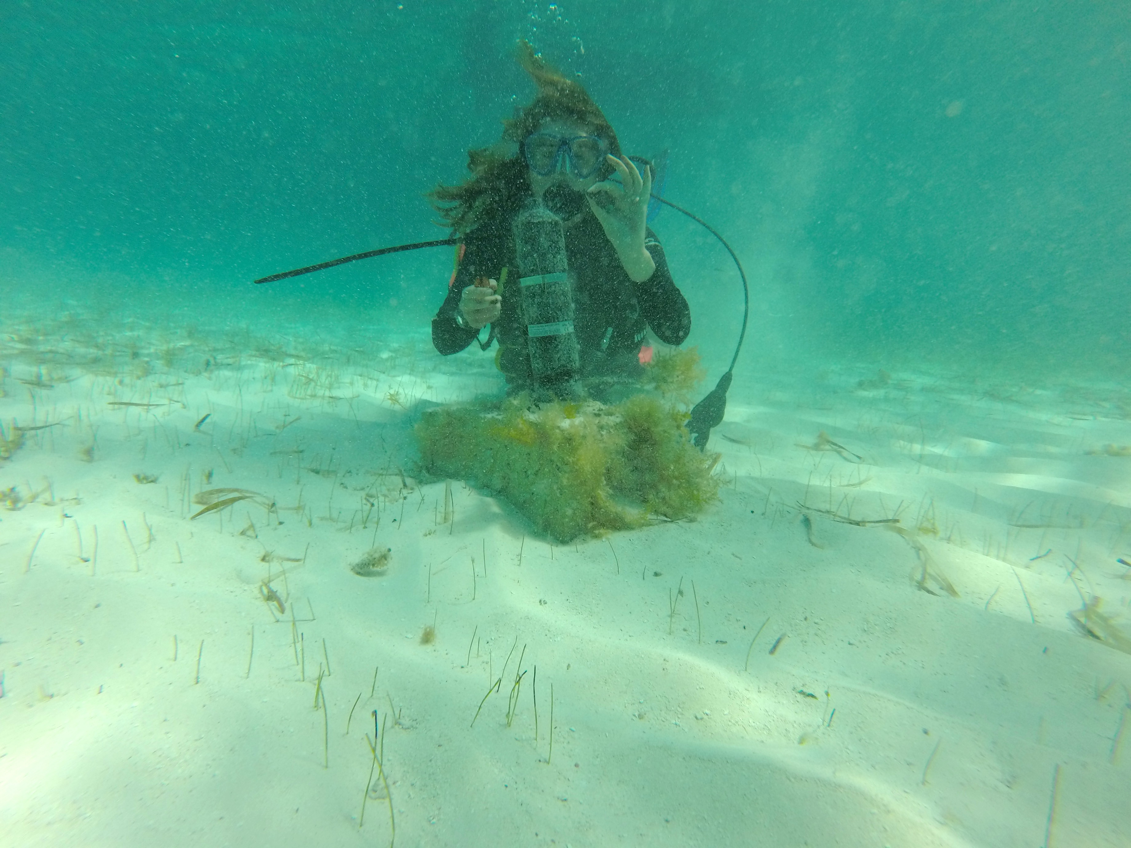
In April, Candice attended the Coastal-Marine Ecosystem Based Management (EBM) Tools Training in San Juan, Puerto Rico facilitated by Nature Serve. Thank you to Kinship Conservation Fellows for supporting Candice’s attendance to this event. EBM Tools Network, a global network of coastal-marine EBM practitioners, researchers, and tool developers, facilitated the training workshop. The session was designed to address the needs of coastal-marine conservation and management practitioners.

The marine spatial planning and marine protected area  planning and management group
The marine spatial planning and marine protected area planning and management group

Ecosystem-based management is an environmental management approach that recognizes the full array of interactions within an ecosystem, including humans, rather than considering single issues, species, or ecosystem services in isolation (Christensen et al. 1996, McLeod et al. 2005). Because humans depend on an array of ocean and coastal functions— including fish as food, for example — EBM recognizes that our welfare and the health of the environment are linked. Put another way, marine and coastal systems provide valuable natural services, or “ecosystem services”, for human communities. Therefore, to protect our long-term wellbeing, we need to ensure marine and coastal ecosystem functions and productivity are managed sustainably. This means managing them in a way that acknowledges the complexity of marine and coastal ecosystems, the connections among them, their links with land and freshwater, and how people interact with them (UNEP (2011): Taking Steps toward Marine and Coastal Ecosystem-Based Management – An Introductory Guide).

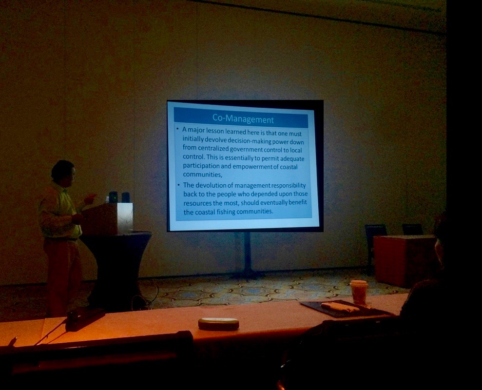
Candice chose to join the marine spatial planning (MSP) and marine protected area (MPA) planning and management theme for the training session. The group discussed stakeholder engagement and co-management strategies for MSP and MPA planning and management, learning from examples in Colombia and Grenada. The group was given an introduction and overview of the United Nations Environment Program (UNEP), Caribbean Marine Protected Areas Management Network and Forum (CaMPAM).

Dr. Martha Prada from UNEP gave a presentation on Design, Declaration and Implementation Strategies of the Seaflower MPA, a case of EBM in the Caribbean. This case study showed the complexities of MPA planning in Colombia and the need to engage all stakeholder groups, promote sustainable development in local communities, research & monitoring, environmental education, alternative livelihoods, licenses/permits, control pollution, and the implications of changing political climate.

Roland Baldeo, the National Marine Protected Area Coordinator for the Government of Grenada, discusses the need for co-management in conservation planning

Roland Baldeo, the National Marine Protected Area Coordinator for the Government of Grenada, gave an example of applied EBM by incorporating pig farmers into MPA management plans. This was achieved by educating farmers about the importance of safeguarding coral reefs and associated ecosystems through sustainable land management practices. By taking farmers on excursions to the areas of coral reef being damaged by pig waste run-off, they were able to demonstrate the linkages between sustainable land management practices and the health of marine ecosystems. This formed the Reef Guardian Farmers group, which recognizes and promotes practices such as proper fertilizer application and good water quality and soil management practices utilized by farmers.

Candice learning how to use Sea Sketch software

Finally participants were trained to use Sea Sketch software by performing exercises from a MPA planning scenario in Barbuda using the program. This unique software enables users to not only incorporate biological data and habitat maps but also allows socio-economic data to be collected from stakeholders via an online link. This information is then visualized as a layer on the map. Fishermen in Barbuda were asked to identify their most important fishing sites, this allows for analytics to be run threw the software to quantify how many fishermen would be displaced based on various MPA placement scenarios, whilst also considering habitat and biological data.

facebooktwittergoogle_plusredditpinterestlinkedinby feather

Shark Research and Conservation Program facilitates another successful year of Oceanic Whitetip (Carcharhinus longimanus) tagging at Cat Island

April saw the sixth successful annual research cruise to study oceanic whitetip sharks at Cat Island. Since 2011, the Shark Research and Conservation Program, along with long-term collaborators Microwave Telemetry Inc (www.microwavetelemetry.com), Stony Brook University, University of North Florida, and Florida International University, have worked closely to answer a number of questions pertaining to the life-history and behavior of a known oceanic whitetip shark aggregation at Cat Island, The Bahamas.  The project is supported and co-funded by Blue Ocean Institute, Save Our Seas Foundation, and the Moore Bahamas Foundation.

Working up an oceanic whitetip and attaching a satellite tag.

Historically, oceanic whitetip sharks were naturally abundant, and a common apex predator across the tropical and sub-tropical western Atlantic. However in the past 50 years, whitetip populations have come under severe threat as a result of the global fin trade. Oceanic whitetips are now categorized as ‘critically endangered’ in the Western Atlantic by the International Union of the Conservation of Nature (IUCN). Despite these pressures, the biology and ecology of this species remains highly elusive, highlighting a critical need for collection of these data from a management and conservation perspective.

The goals of the study are to:

  1. Determine generalized movements and determine high-use areas of sharks in relation to the Bahamas shark sanctuary.
  2. Examine diving behavior through high resolution temperature and depth data.
  3. Investigate potential hormone markers to identify reproductive cycles.
  4. Examine prey-preference potential seasonal diet switches through tracing relative concentrations of Carbon and Nitrogen isotopes.
  5. Gather baseline genetics data which will be incorporated into fin-trade management, and will detect fins from Oceanic whitetips found in the Western Atlantic.

This year, over a six day cruise, the team captured and released a total of 15 oceanic whitetips, and attached pop-up satellite tags (PSAT’s) measuring archived temperature, depth and light levels(used to define location) to 12 females. The tags are pre-programmed to record for a desired deployment duration ranging from 14 days to 12 months before detaching from the animal. Once the tag detaches, a sub-set of archived data is transmitted to a satellite system, meaning the tag does not need to be recovered.  The main focus of this year’s cruise was to tag confirmed pregnant (via ultrasound) and recaptured individuals, to identify hormone pregnancy markers, and potential pupping grounds.

The oceanic whitetip shark (Carcharhinus longimanus). Photo by Sean Williams.

Investigating these large knowledge gaps are intrinsic to the contemporary management of oceanic whitetip shark populations, and will provide novel insights into the biology and ecology of a severely threatened apex predator.

facebooktwittergoogle_plusredditpinterestlinkedinby feather

Stingray team reaches important milestone

The stingray team has been hard at work over the last month and has recently broken an important milestone passing n=300 capture events. We now have 347 captures with 195 individual rays (49 Himantura schmardae and 146 Dasyatis americana) and 152 recaptured rays.

Shark Research and Conservation Programme intern Katie Luniewicz holds a juvenile Caribbean whiptail stingray before release

With the high level of capture events occurring this has enabled graduate student Daniel Montgomery to successfully tag 38 southern stingrays with temperature loggers, with 7 loggers having been retrieved from stingrays to date. Initial analysis of data has shown a diel pattern in temperatures experienced by stingrays possibly related to tidal cycles in these shallow water environments, however more tags are required in order to make more detailed analysis of trends in the data. Alongside this work Daniel has also been advising an Island School research class who will prevent initial findings of the study at the Island School Research Symposium at the end of May.

A Southern stingray swims away from the team following capture

Other work conducted by the team includes continued sampling of Caribbean whiptail stingrays in order to analyse genetic connectivity of rays found in different locations throughout the Bahamas. Recently the team explored a mangrove creek at Wemyss Bight after receiving a tip-off that several rays had been seen by fly fishermen the previous week. During a lengthy walk amongst the mangrove creek the team captured and sampled 5 immature whiptail rays added significantly to our current dataset.


The ventral view of a whiptail stingray showing the animals gill slits

With the continued field work we anticipate capturing our 200th individual stingray across both projects in the near future!

facebooktwittergoogle_plusredditpinterestlinkedinby feather

It’s Earth Day in Eleuthera!

Last Saturday (April 23rd) the new Center for Innovation and Training hosted an Earth Day festival in Rock Sound at which the Cape Eleuthera Institute (CEI) and Center for Sustainable Development (CSD) community participated. The team, comprised if interns and staff, had a booth showcasing projects being conducted by CSD and information about our research initiatives and the environmental concerns they address.

26695240491_4de9430984_k

From the Center for Sustainable Development the biodiesel and facilities team member Sam Dorcent brought in a big crowd by making biodiesel right on site. Michael Bowleg, aquaponics technician, displayed a mini aquaponics system and discussed how sustainable farming is possible in sandy island environments.

26762167945_558ca4ef39_k

From the Cape Eeuthera Institute messages, games and information focused on: the invasive lionfish and the importance of culling this delicious, edible fish. The reef team was also promoting lionfish fin jewelry made by local artists. Sustainable conch harvesting was communicated using visual aids, games aimed at debunking common fishing misconceptions and stressed the importance of harvesting only mature conch in order to keep this fishery alive in the future. The regulations on sea turtle harvest in The Bahamas were explained and children were able to practice measuring turtles with a realistic stuffed toy sea turtle. Finally, several specimens of sharks and rays were on display and their importance in local ecosystems highlighted through a True/False quiz with children regarding the many misconceptions that surround sharks and rays in The Bahamas.

26762227715_9a2dc6087f_k

The energy at the Earth Day festival was high with musical performances and vibrant food stands that really brought together the whole event. Overall the event was really successful, full of family fun and informed people about better ways to take care of the planet. We look forward to next years festival!

facebooktwittergoogle_plusredditpinterestlinkedinby feather

Will climate change have an effect on the lionfish invasion?

With rising atmospheric carbon dioxide (CO₂), primarily from anthropogenic impacts, oceans are absorbing CO₂ at an alarming rate. This additional CO₂ changes seawater pH and chemical composition, profoundly affecting marine ecosystems. Future predictions highlight a continual increase in CO₂, which several studies have shown to affect a broad range of marine organisms, including ecologically important plankton, coral and fish species.  A species which lacks any CO₂ related research however, is the invasive lionfish. Lionfish have a resilient nature, with a temperature tolerance range of 10˚C – 35˚C and a salinity tolerance range of 7ppt – 35ppt. Coupled with the ability to produce 30,000 eggs every two to three days, a lack of predators and a broad habitat type, there seems to be no barrier to this well adapted invader. Now prevalent in their invaded range in the Western Atlantic in an area of over 7 million km² in just 25 years, and with the ability to decrease native fish populations by 65%, studies into resilience to other environmental factors is fundamental in predicting future impacts.


Lionfish acclimating in our wetlab here at CEI.

Research Technicians Helen Conlon and Rob Drummond, supervised by Dr. Shultz and Dr. Curtis-Quick, started their collaborative independent research project investigating whether future worst case scenario CO₂ levels has the potential to affect invasive lionfish hunting behaviour and physiology. Results will aid the mitigation management of the invasion, either by additional emphasis for the need for immediate control methods, or concluding that hunting will be altered in the presence of increased CO₂. Stay tuned for more updates!

facebooktwittergoogle_plusredditpinterestlinkedinby feather

New study assessing seagrass productivity across South Eleuthera

This semester, the Sea Turtle Research and Conservation team has been collecting seagrass samples from various study sites around South Eleuthera where green sea turtles have been sighted since the start of the program in 2012. The new study will assess the productivity, composition and distribution of seagrass and compare this to the relative abundance of the local green turtle (Chelonia mydas) population on each site.

Quadrat use to estimate seagrass and algae cover

Seagrass communities are one of the most productive and dynamic ecosystems globally. They provide habitats and nursery grounds, and act as substrate stabilizers. Also, seagrass meadows are a major food source for a number of grazing animals and are considered very productive pastures of the sea. For example, an adult green turtle can eat about two kilograms of seagrass a day, which helps to maintain a healthy environment, increasing the productivity and nutrient content of seagrass.

Monitoring seagrass resources is important for two reasons: it provides a valuable tool for improving management practices and it allows us to know the status and condition of these ecosystems.

Seagrass sample from Broad Creek

It is known that the die-off or decline of seagrass has a direct effect on green turtle populations.  We know that seagrass meadows are exploited year-round mainly by juvenile and sub-adult green turtles and their distribution may be related to the dynamics of the seagrass beds. For example, in Florida Bay and the Gulf of Mexico the loss of seagrass cover during the 1980’s was linked to the ecological extinction of green turtles. The decrease on the cover and density of seagrass and green turtle population worldwide might be in some level due to natural causes (diseases, storms, etc), but the major threat facing both seagrass and sea turtles are human interactions (pollution, habitat degradation, direct or indirect take, among others).

The team and the Island School research class have been collecting seagrass samples, then counting and weighing seagrass shoots and leaves to assess the biomass (above and below ground) and density of the different species of seagrass found in those study sites. The results of this research will be presented by students of The Island School at the end of May Island School Research Symposium.

Spring Island School class 2016 after a day of sampling seagrass

This event is an opportunity to learn more about the ongoing research carried out at the Cape Eleuthera Institute so please contact Candice Brittain if you are interested in attending (candicebrittain@islandschool.org).

Follow our sea turtle research here.

facebooktwittergoogle_plusredditpinterestlinkedinby feather

Check out this bonefish research happening at night!

The research team led by Dr. Aaron Shultz and Georgiana Burruss (CEI) spent four nights out manually tracking bonefish spawning aggregations near Cape Eleuthera. Bonefish school at a nearby location and move along the coast at night to spawn in deep water. By tracking the fish offshore at night, the team will gain an understanding of where and when the aggregation is spawning as well as how weather, lunar phase, and tidal cycle might impact spawning patterns.

Directional and omnidirectional hydrophone are used with the VR100 receiver to track bonefish

The team deployed two gastric transmitters that signal the receiver every second, allowing the bonefish to be tracked manually using a VEMCO VR100 receiver. To deploy the gastric transmitters, bonefish are captured from the aggregation using a handline. The transmitter is then pushed down the esophagus of the fish using a small tube. Each fish is given an hour to recover and then returned to the aggregation. At sunset, the fish in the aggregation move to the surface of the water, exhibiting a behavior called porpoising, in which the bonefish rush to the surface and gulp air. This behavior typically occurs several hours before bonefish move down to depths of over 150ft. After sunset, the team follows the aggregation overnight, taking GPS waypoints every 15 minutes. This data is used to generate a path that the aggregation takes from sunset to sunrise. Over 4 nights, the aggregation moved from shallow coral reef areas(<2m) to deep open ocean environments (>30m) and then returned to their prespawning site by sunrise. Several studies have suggested that bonefish aggregations move to deep water to spawn; we have tracked two trips to the Exuma Sound so far. Interestingly, one of the tagged barracuda closely followed the bonefish aggregation for over 6 hours!

Gastric transmitter inserted into the bonefish
Mature male bonefish captured by a handline from a bonefish prespawning aggregation

The team hopes to track bonefish aggregations to their spawning sites over the coming months. For more information about our research and how to support, please contact georgianaburruss@islandschool.org and aaron.dean.shultz@gmail.com. Stayed tuned for more updates!

facebooktwittergoogle_plusredditpinterestlinkedinby feather

New study addressing predator interactions with bonefish spawning aggregations

In February, the research team led by Dr. Aaron Shultz and Georgiana Burruss (CEI) successfully implanted the last bonefish with an acoustic transmitter, bringing the sample size to 39 bonefish that they will track over the next three years! The data collected from these fish will provide insight into the locations of movement corridors and prespawning aggregations, as well as potential cues for bonefish spawning (e.g., moon cycle, tidal cycle, weather patterns, etc.). These locations can then be used to designate marine protected area that will aid in the conservation of this ecologically and economically important species.

Team preps for surgery


A second study was recently launched to evaluate if bonefish prespawning aggregations  attract predators. Anecdotally, coastal predators such as sharks and Great Barracuda have been observed preying on spawning aggregations of bonefish. Unfortunately, these associations between predators and spawning aggregations are not well-studied, resulting in a knowledge gap regarding how bonefish aggregations could dictate the abundance of apex predators in localized areas. Using a known bonefish prespawning aggregation as a model, this study aims to determine if bonefish aggregations attract predators and if these predators are returning to the aggregation site repeatedly. Barracuda are a known predator of bonefish in shallow flats and they are common near the location of the bonefish prespawning aggregation, making them an ideal species to study predator movement patterns in relation to bonefish aggregation.

With the assistance of Zach Zuckerman, barracuda were captured using SpiderWire and Dyneema fishing line at locations near and far-away from the bonefish prespawning aggregation. VEMCO acoustic transmitters were surgically implanted into 14 barracuda. These fish will be tracked passively, utilizing the receiver array placed around the island, as well as actively, when researchers are tracking bonefish aggregations overnight. Surprisingly, one barracuda closely followed a bonefish spawning aggregation for over 6 hours!

Georgie Burruss closes the incision on a Great Barracuda


This study will continue to track bonefish and predator movements around Eleuthera over the next three years. For more information about our research and how to support, please contact georgianaburruss@islandschool.org and aaron.dean.shultz@gmail.com. Keep an eye out for more updates!


facebooktwittergoogle_plusredditpinterestlinkedinby feather

First Island School Student to Presents Research Poster at BNHC

Andrieka presenting the ponds research

CEI was well represented at the regional 2016 Bahamas Natural History Conference, with representatives giving talks on plastics, climate change, rare shrimp, turtles, conch, sharks and lionfish. More excitingly, the first Island School alumni joined with the research team! Andrieka Burrows, BESS scholar of Fall 2015, attended the conference to present the anchialine ponds poster. Anchialine ponds are landlocked bodies of water with marine characteristics that are connected to the sea through underground conduits. There are over 200 of these ponds on the island of Eleuthera, however, there is very little known about these ecosystems. Dr. Jocelyn Curtis-Quick and Alexio Brown, with a team of Island School students, including Andrieka, gathered baseline data on the ponds in order to determine their status and need for protection.

There was much interest in the inland ponds work
Research advisor Alexio Brown and Dr Curtis-Quick were very proud of Andrieka

The students found an alarming number of the ponds were impacted by humans.  To conserve these ecosystems, there is a need to raise awareness. Andrieka did this by presenting the work of her research class at the Bahamas Natural History Conference (BNHC). The conference was hosted by the Bahamas National Trust (BNT), who manage the protected areas in The Bahamas. Andrieka spoke about why these ponds are so understudied, and her hopes for more research to be carried out in the future.

“The Bahamas Natural History Conference turned out to be all that I expected,” said Andrieka. “Not only did I get the opportunity to interact with world renowned scientists, who presented their captivating work, but I also got to present my anchialine pond research to these very same scientists.”

Andrieka created much interest in ponds, and did an exceptional job presenting the poster, making her research very advisors proud.

facebooktwittergoogle_plusredditpinterestlinkedinby feather

Flats team picks up acoustic receivers and finds elkhorn coral

Georgie Burruss secures a receiver to a cinderblock after downloading the data from the device.

Last week, the Flats Ecology and Conservation team downloaded data from a large-scale passive acoustic telemetry array designed to track bonefish to their pre-spawning aggregations. A total of 61 receivers were placed around Eleuthera to track the movements of 39 bonefish and 14 barracuda that were implanted with acoustic transmitters. The research team downloaded key receivers and found schools of bonefish moving over coral reef habitats at night near tidal creeks on the East coast of Eleuthera, indicating that these fish may move offshore to spawn on the windward side of the island. Stay tuned for more updates in June.

A healthy stand of Elkhorn coral
Helen Conlon signals okay after redeploying a receiver.

As a bonus, while collecting receivers the team got to swim by several Elkhorn coral (Acropora palmata) colonies, an IUCN-listed critically endangered species. Elkhorn coral grows rapidly, providing significant structure and habitat for reefs throughout the Caribbean, though it is in severe decline as a result of coral bleaching, predation, storm damage, disease, and human activity. Though it was heartening to see so many healthy colonies of this critically endangered species, they are small compared to the large stands of dead elkhorn that used to thrive in the area. Our reef restoration project has begun mapping these areas and will be monitoring its growth.

facebooktwittergoogle_plusredditpinterestlinkedinby feather